The Black Swamp
Cock Ring
Featured. Built by running a 3,847-row county dataset against the federal government's own 1938 grading map. Eighty-six per cent of the public's vacant lots sit on ground that map marked C or D.Destacado. Elaborado cruzando un conjunto de datos del condado de 3.847 filas con el mapa de calificación que el propio gobierno federal trazó en 1938. El 86% de los solares vacíos de titularidad pública está en terreno que aquel mapa marcó con C o D.
The public owns 3,847 vacant lots in Lucas County. It is offering 1,754, and no published rule says which.El público es dueño de 3.847 lotes baldíos en el condado de Lucas. Ofrece 1.754, y ninguna norma publicada dice cuáles.
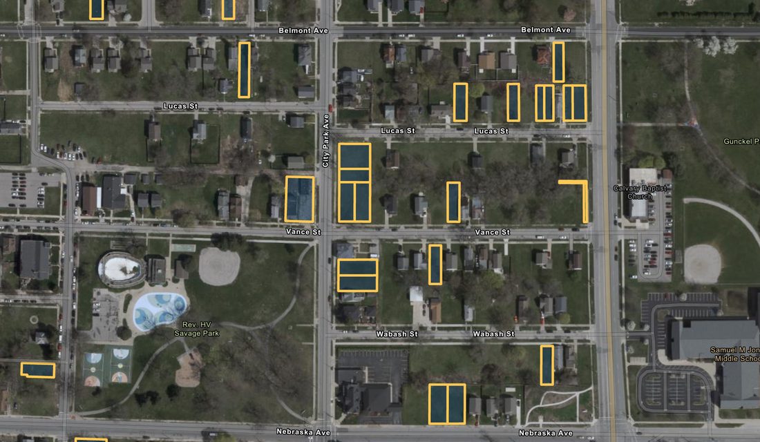
There are 27,526 vacant parcels in Lucas County. The City of Toledo owns 3,492 of them and the county land bank owns 355 — 3,847 between them, one in seven of every empty parcel in the county. The public dashboard the two of them launched on July 28 lists 1,754 for sale. That is 45.6% of what the public owns. The other 2,093 parcels are not on the map, and nothing published anywhere says why.Hay 27.526 parcelas baldías en el condado de Lucas. La Ciudad de Toledo posee 3.492 y el banco de tierras del condado otras 355 — 3.847 entre ambos, una de cada siete parcelas vacías del condado. El tablero público que ambos lanzaron el 28 de julio ofrece 1.754 a la venta. Eso es el 45,6% de lo que el público posee. Las otras 2.093 parcelas no están en el mapa, y nada publicado en ninguna parte dice por qué.
The promise made at the launch was retail. “People like to shop online,” said David Mann, president and chief executive of the land bank. “This is an online shopping opportunity because you can go to the map that we’ve made available and see in real-time every lot that is available right now in your neighborhood.” Lindsay Webb, the county treasurer, described the buyer they had in mind: “You don’t have to have a background as a real estate expert or as a title examiner or a savvy investor, you can be Joe and Mary in 43613.”La promesa hecha en el lanzamiento fue comercial. «A la gente le gusta comprar en línea», dijo David Mann, presidente y director ejecutivo del banco de tierras. «Esto es una oportunidad de compra en línea, porque puedes ir al mapa que hemos puesto a disposición y ver en tiempo real cada lote disponible ahora mismo en tu barrio». Lindsay Webb, tesorera del condado, describió al comprador que tenían en mente: «No hace falta ser experto inmobiliario ni examinador de títulos ni un inversionista astuto; puedes ser Juan y María en el 43613».
Aspiring homeowners who take the city up on its word may find themselves disappointed — not by the shopping, which works, but by everything after it.Quienes aspiren a tener casa y tomen a la ciudad por su palabra pueden llevarse una decepción — no por la compra en sí, que funciona, sino por todo lo que viene después.
Click a yellow parcel and four lines come up: address, parcel number, zoning, acreage, and a link to the county record. There is no price. There is no price anywhere on the dashboard, no range, and no button to make an offer. The data layer underneath it carries no price field at all.Haga clic en una parcela amarilla y aparecen cuatro líneas: dirección, número de parcela, zonificación, superficie y un enlace al registro del condado. No hay precio. No hay precio en ninguna parte del tablero, ni un rango, ni un botón para hacer una oferta. La capa de datos que hay debajo no tiene campo de precio.
Prices do exist. They are just somewhere else. A side lot — a vacant parcel sharing an edge with a house you already own — costs $10 for each foot of street frontage, with a $100 minimum. A 40-foot lot is $400. The land bank invites eligible neighbors to apply rather than the other way round, and the buyer has to combine the lot with the parcel next to it. Building a house is a different regime entirely: a non-refundable $500 option fee holds a lot while zoning, permits and financing are worked out, the land bank then sells at fair market value, and at closing the buyer signs a legal promise to build by a set date, secured by a mortgage on the land that is released when the certificate of occupancy issues.Los precios existen. Solo que están en otra parte. Un lote lateral — una parcela baldía que comparte lindero con una casa que ya se posee — cuesta 10 dólares por cada pie de frente de calle, con un mínimo de 100. Un lote de 40 pies cuesta 400. El banco de tierras invita a solicitarlo a los vecinos elegibles, y no al revés, y el comprador debe unir el lote a la parcela contigua. Construir una casa es otro régimen distinto: una cuota de opción no reembolsable de 500 dólares reserva el lote mientras se resuelven zonificación, permisos y financiamiento; el banco de tierras vende entonces a valor de mercado, y en el cierre el comprador firma el compromiso legal de construir para una fecha determinada, garantizado con una hipoteca sobre el terreno que se libera al emitirse el certificado de ocupación.
That last regime is where the shopping stops. The lot is the cheap part, and on many of these it is nearly free. Building on it is not. In 43607 and 43608 the comparable sales an appraiser has to work from will not support what a new house costs to put up, and a conventional mortgage does not close across that gap. Which is why what actually moves this land is side lots sold to the neighbor, subsidized builders, community gardens, and deals with a tax abatement attached.Ese último régimen es donde se acaba la compra. El lote es la parte barata, y en muchos de estos casi regalada. Construir encima no lo es. En el 43607 y el 43608, las ventas comparables con las que debe trabajar un tasador no sostienen lo que cuesta levantar una casa nueva, y una hipoteca convencional no se cierra sobre esa diferencia. Por eso lo que de verdad mueve este suelo son lotes laterales vendidos al vecino, constructores subvencionados, huertos comunitarios y acuerdos con una exención fiscal adosada.
As for the 2,093 parcels that are not on the map, the dashboard’s own data answers what its documents do not. Every one of the 1,754 listed parcels carries the same flag in the county property system: a process code reading “Land Bank Publicity.” All 1,754 of them, and nothing else. A parcel appears on the public map if, and only if, somebody has set that flag on it by hand. Nothing the land bank publishes — not its articles of incorporation, its code of regulations, its purchasing policy, or its memorandum of understanding with the city — defines who sets it or on what test. The dashboard says only that a listing “does not constitute an offer for sale.” The side-lot page says some lots are “being held for strategic assembly purposes.” Between those two sentences and 2,093 parcels, there is no published rule.En cuanto a las 2.093 parcelas que no están en el mapa, los propios datos del tablero responden lo que no responden sus documentos. Cada una de las 1.754 parcelas listadas lleva la misma marca en el sistema de propiedad del condado: un código de proceso que dice «Land Bank Publicity». Las 1.754, y nada más. Una parcela aparece en el mapa público si, y solo si, alguien le ha puesto esa marca a mano. Nada de lo que publica el banco de tierras — ni sus estatutos, ni su reglamento, ni su política de compras, ni su convenio con la ciudad — define quién la pone ni bajo qué criterio. El tablero solo dice que un anuncio «no constituye una oferta de venta». La página de lotes laterales dice que algunos se «reservan con fines de ensamblaje estratégico». Entre esas dos frases y 2.093 parcelas, no hay norma publicada.
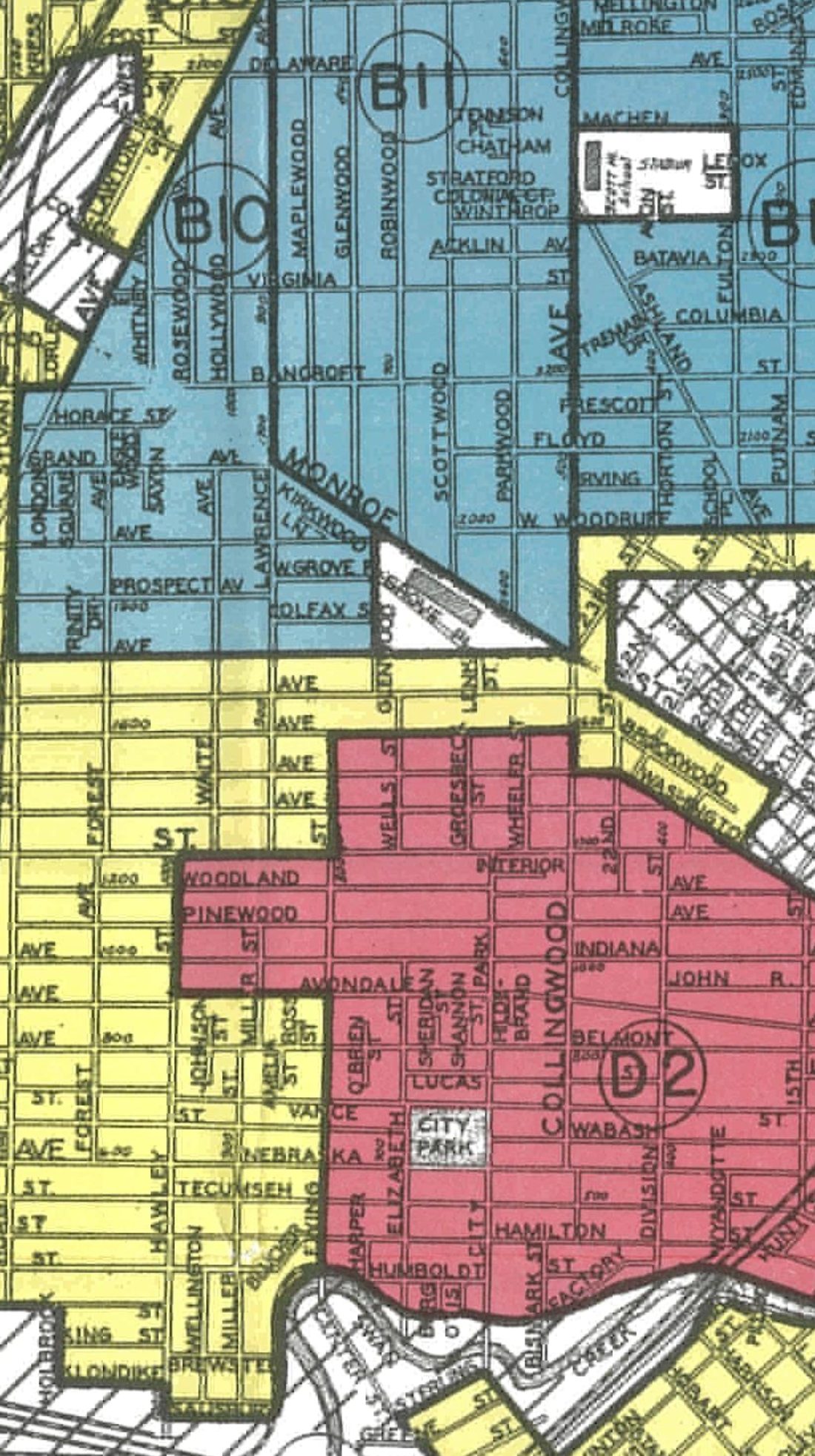
Which leaves the older question of how the ground came to be empty. In 1938 the federal Home Owners’ Loan Corporation, working with local Toledo real-estate men, graded 78 areas of this city A through D and colored them green, blue, yellow and red. The agency’s own lending had ended two years earlier; the maps did not invent the practice of refusing mortgages by neighborhood so much as write it down and standardize it. What they wrote down is not ambiguous. Of area D3, south of Swan Creek: “Suffers from smoke, dirt, and all around bad influences. Colored area.” Mortgage funds available there for home purchase: “No.” Of D9, the near north side: “Oldest slum district in town.” Home purchase funds: “None.” Red was not reserved for Black blocks alone — D1, on the west side, had no Black residents and was called “fairly clean as Class ‘D’ areas go. Poor class of residents.” But on every sheet this paper has read where the surveyors recorded a Black population, the grade was D.Queda entonces la pregunta más antigua: cómo llegó ese terreno a quedar vacío. En 1938 la federal Home Owners’ Loan Corporation, junto con corredores inmobiliarios locales de Toledo, calificó 78 zonas de esta ciudad de la A a la D y las coloreó de verde, azul, amarillo y rojo. Los préstamos de la propia agencia habían terminado dos años antes; los mapas no inventaron la práctica de negar hipotecas por barrio, sino que la pusieron por escrito y la estandarizaron. Lo que pusieron por escrito no es ambiguo. De la zona D3, al sur del Swan Creek: «Sufre de humo, suciedad y malas influencias en general. Zona de color». Fondos hipotecarios disponibles allí para comprar vivienda: «No». De la D9, el norte cercano: «El distrito de tugurios más antiguo de la ciudad». Fondos para compra: «Ninguno». El rojo no se reservó solo para las manzanas negras — la D1, en el lado oeste, no tenía residentes negros y fue descrita como «bastante limpia para ser zona de clase ‘D’. Clase pobre de residentes». Pero en todas las hojas que este periódico ha leído en las que los topógrafos anotaron población negra, el grado fue D.
Lay the 3,847 lots over that map. 3,292 of them — 85.6% — fall inside areas graded C, “definitely declining,” or D, “hazardous.” The D areas were about 6% of the ground the surveyors graded and hold 15% of the public’s vacant land today, two and a half times their share. Of 3,847 lots, 21 sit in areas graded A. The concentration holds by ZIP code as well: four — 43607, 43608, 43609 and 43604 — hold 2,414 parcels, 63% of the inventory. Six hold 81%. 43607 alone holds 1,051, better than a quarter of everything the public owns. On single streets: 102 publicly owned vacant lots on North Detroit Avenue, 88 on Hamilton, 83 on Tecumseh, 81 on Belmont, 76 on Avondale. Nine in ten of the parcels are zoned residential. This is not riverbank or industrial ground the city ended up holding. It is where houses were.Superponga los 3.847 lotes sobre ese mapa. 3.292 de ellos — el 85,6% — caen dentro de zonas calificadas C, «en clara decadencia», o D, «peligroso». Las zonas D eran alrededor del 6% del terreno que calificaron los topógrafos y hoy contienen el 15% del suelo baldío público, dos veces y media su proporción. De 3.847 lotes, 21 están en zonas calificadas A. La concentración se sostiene también por código postal: cuatro — 43607, 43608, 43609 y 43604 — reúnen 2.414 parcelas, el 63% del inventario. Seis reúnen el 81%. Solo el 43607 tiene 1.051, más de la cuarta parte de todo lo que el público posee. En calles concretas: 102 lotes baldíos públicos en North Detroit Avenue, 88 en Hamilton, 83 en Tecumseh, 81 en Belmont, 76 en Avondale. Nueve de cada diez parcelas tienen zonificación residencial. No es ribera ni suelo industrial que la ciudad acabó reteniendo. Es donde había casas.
The 1938 map is not the only thing that happened to that ground, and the city has said so itself. Toledo’s 2023 federal grant application for the Junction neighborhood sets out the sequence in its own words: redlined in the 1930s, “leading to disinvestment that laid the groundwork for the displacement of communities associated with Interstate 75”; the highway cut in during the 1960s, leaving four road connections where there had been thirteen; then Dorr Street widened in the 1970s, with “hundreds of homes and businesses” demolished and more than 100 Black businesses displaced. By 1970 about a fifth of the city’s land area had been cleared or was being cleared in the name of urban renewal. The application’s own description of Junction now: 40% of the neighborhood is vacant.El mapa de 1938 no es lo único que le pasó a ese terreno, y la propia ciudad lo ha dicho. La solicitud federal de subvención que Toledo presentó en 2023 para el barrio de Junction expone la secuencia con sus propias palabras: marcado en rojo en los años treinta, «lo que llevó a una desinversión que sentó las bases del desplazamiento de comunidades asociado a la Interestatal 75»; la autopista lo cortó en los años sesenta, dejando cuatro conexiones viales donde había habido trece; luego el ensanche de Dorr Street en los setenta, con «cientos de viviendas y negocios» demolidos y más de 100 negocios de propietarios negros desplazados. Para 1970, cerca de una quinta parte de la superficie de la ciudad había sido despejada o estaba siendo despejada en nombre de la renovación urbana. La descripción que la propia solicitud hace de Junction hoy: el 40% del barrio está baldío.
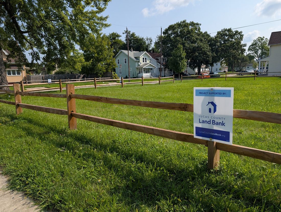
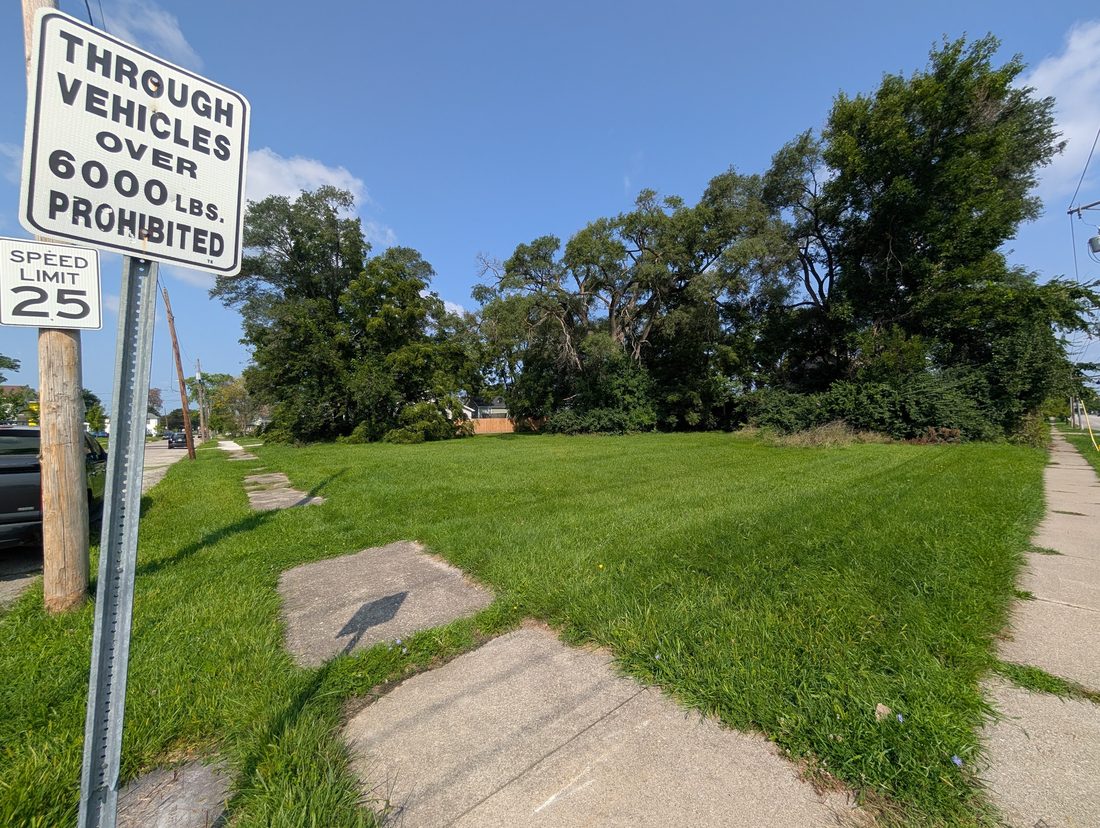
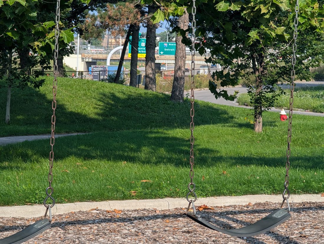
Holding the ground is not free either. An assessment commissioned by the city in 2021 put the cost of mowing and maintaining vacant lots at about $2 million a year — more than 20,000 separate cuts were ordered in 2019 — with the land bank spending roughly $500,000 more on top. Set that against what the same ground would pay if somebody else owned it. The unimproved parcels the city and the land bank hold carry about $38.4 million in auditor’s value; at an effective rate of roughly 1.92%, derived here from the auditor’s own charges against 24,278 taxable Toledo residential parcels, they would generate something near $738,000 a year. The mowing costs more than the tax. And the total hides the ordinary case, because a handful of parcels carry most of that value: the median lot in the public inventory is valued at $800 and would owe about $15 a year. Publicly owned land is lawfully exempt, so none of this is a bill going unpaid. It is the price of holding.Tampoco es gratis conservar el terreno. Una evaluación encargada por la ciudad en 2021 situó el costo de segar y mantener los lotes baldíos en unos 2 millones de dólares al año — en 2019 se ordenaron más de 20.000 cortes por separado — y el banco de tierras gasta unos 500.000 más. Compárese con lo que ese mismo suelo pagaría si fuera de otro dueño. Las parcelas sin edificar que tienen la ciudad y el banco de tierras suman unos 38,4 millones de dólares de valor según el auditor; a una tasa efectiva de aproximadamente 1,92%, deducida aquí de los propios cargos del auditor sobre 24.278 parcelas residenciales imponibles de Toledo, generarían cerca de 738.000 dólares al año. Segar cuesta más que el impuesto. Y el total esconde el caso corriente, porque unas pocas parcelas concentran casi todo ese valor: el lote mediano del inventario público está valorado en 800 dólares y debería unos 15 al año. El suelo de propiedad pública está legalmente exento, así que nada de esto es una factura impagada. Es el precio de tenerlo.
Two things this paper is not asserting. Not all 3,847 parcels are sellable: some are rights-of-way, some are flood buyouts, some are already committed to projects. And this piece is built from records rather than interviews — the paper has read every document the land bank and the city publish about how this inventory is disposed of, and none of them answers the question. Until that breakdown exists, the size of the gap between what the public owns and what the public is offered is a question, not a finding.Dos cosas que este periódico no afirma. No todas las 3.847 parcelas son vendibles: algunas son servidumbres de paso, algunas son compras por inundación, algunas ya están comprometidas con proyectos. Y este texto está construido con registros, no con entrevistas — el periódico ha leído todos los documentos que el banco de tierras y la ciudad publican sobre cómo se dispone de este inventario, y ninguno responde la pregunta. Mientras no exista ese desglose, el tamaño de la brecha entre lo que el público posee y lo que se le ofrece es una pregunta, no un hallazgo.
The ownership figures are a snapshot taken July 29, and the 1938 overlay is built on that snapshot. Re-queried this morning, the county’s count of vacant parcels still read 27,526, unchanged; public holdings had risen to 3,864. The 1,754 came from the dashboard’s own data layer today. At the launch on July 28 the figure reported was about 2,000.Las cifras de propiedad son una instantánea tomada el 29 de julio, y la superposición de 1938 está construida sobre ella. Al volver a consultarlo esta mañana, el recuento condal de parcelas baldías seguía marcando 27.526, sin cambios; las propiedades públicas habían subido a 3.864. Las 1.754 salieron hoy de la capa de datos del propio tablero. En el lanzamiento del 28 de julio la cifra publicada era de unas 2.000.
TOLEDO — Lucas County Auditor public GIS (Vacant_Parcels; AREIS general collections), July 29 and Aug. 23, 2026; City of Toledo public land data layer; Lucas County Land Bank published program and governing documents; Mapping Inequality / Digital Scholarship Lab, University of Richmond, for the 1938 HOLC boundaries and area descriptions; City of Toledo 2023 RAISE grant application; Toledo code enforcement assessment, January 2021; the paper’s own spatial join and arithmetic.TOLEDO — GIS público del Auditor del condado de Lucas (Vacant_Parcels; colecciones generales de AREIS), 29 de julio y 23 de agosto de 2026; capa pública de datos de suelo de la Ciudad de Toledo; documentos de programa y de gobierno publicados por el banco de tierras del condado de Lucas; Mapping Inequality / Digital Scholarship Lab, Universidad de Richmond, para los límites y las descripciones de zona del HOLC de 1938; solicitud de subvención RAISE de la Ciudad de Toledo, 2023; evaluación de cumplimiento de códigos de Toledo, enero de 2021; unión espacial y aritmética propias del periódico.
CONTINUE TO THE REST OF THE PAPER →Esta nota abrió la No. 25. La edición es la unidad de este periódico: la viñeta, el resumen, las secciones, las correcciones y las fuentes viven allí, no aquí.
SEGUIR AL RESTO DEL PERIÓDICO →